Assam’s soil erosion worsening with climate change and floods
With intensifying monsoons and deepening soil erosion, Assam is becoming one of India’s states most vulnerable to climate change, hurting food production and livelihoods in the process.

With intensifying monsoons and deepening soil erosion, Assam is becoming one of India’s states most vulnerable to climate change, hurting food production and livelihoods in the process.
Each year, during the monsoon, the mighty Brahmaputra River and its tributaries burst their banks and engulf huge tracts of farming and residential land in the remote north-eastern state of Assam, home to 34 million people.
The state government, engineers and other experts are exploring new ways to manage the effects of the annual flooding and increasingly intense bouts of rainfall.
But small landholder Bhakto Bahadur Chhetri said it is already too late to save his home and one-hectare plot of land that provides food and a livelihood for his family.

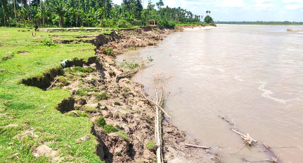
“The river is just 100 metres away from my land. I will lose everything to the river,” said Chhetri, who notes floodwaters have already swallowed 70 per cent of his village of Khagrabari in Udalguri district. “I realize I can’t do anything to stop the river,” he said.
The monsoon has become more erratic and the rainfall more frequent and heavier, which many environmentalists blame on climate change.
The river is just 100 metres away from my land. I will lose everything to the river.
Increasing deforestation, meanwhile, means there are no roots to stop the soil from being washed away. But poor flood-control management and upkeep of embankments are perennial problems that add to the flooding.
Fifteen of the 25 districts in India most vulnerable to climate change are in Assam and there’s been an “exponential increase in the frequency of flood events since 2010,” Climate Change Minister Keshab Mahanta told the state assembly in mid-September.
Worse times lie ahead, Mahanta warned. He cited a state government report that projects “extreme rainfall events” are likely to increase by up to 38 per cent and floods by more than 25 per cent by mid-century.
From 2014 to 2021 more than 32 million people in Assam were affected by flooding and nearly 660 people died, Assam’s disaster management agency said.
This year, Assam was hit by the worst flooding in over a decade with 32 of the state’s 35 districts affected. More than 70 people lost their lives.

Other factors behind the increased flooding are sediment from bank erosion and run-off erosion that have raised riverbeds and meant the rivers can carry less water. The Brahmaputra has washed away 427,000 hectares of land during the last 70 years, according to state figures.
The Brahmaputra’s width has increased by up to 15 km in some parts due to bank erosion of which a graphic example is scenic Majuli, the world’s largest river island. The island’s area in the early 20th century covered 880 sq km, but now it is only 352 sq km.
The island’s home to the famed Vaishnavite monasteries, known as satras, which follow the teachings of Srimanta Sankardev, a 15-century religious and social reformer who’s called the father of Assamese culture. Due to erosion, of the island’s original 65 satras, just 22 remain.
In the past receding flood waters would leave behind nutrient-rich alluvial deposits that fertilised the land on which farmers grow rice, vegetables and other crops.
But the waters now carry often only sediment from upper catchment areas in Assam as well as neighbouring states and the frequent flooding means fertile topsoil gets washed away.
An increasing population is piling more pressure on the fragile ecology.
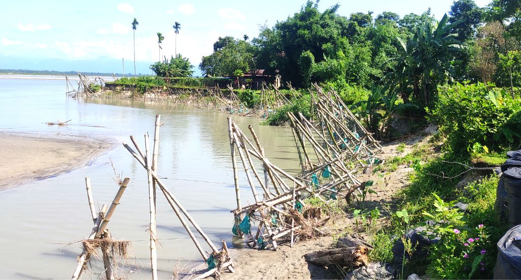
The state government began building levees along the Brahmaputra in the 1960s. But most have now outlived their usefulness or are in bad condition.

Others have been washed away.
Some experts say the embankments and other manmade changes to the riverbed may also be part of the problem and that new methods are needed to control the flooding.
For instance, there’s hydroseeding, a technology involving spraying a slurry seed, mulch fertiliser and bonding agents onto the ground that grows swiftly and can be used to hold slopes together in rain-induced landslides.
Five years ago, the river was two kilometres away from our house but now it’s only 70 metres away.
Then, there’s vetiver grass technology used to form a horizontal root mat that grows up to four metres below ground level and binds the soil.
Bioengineers say this can cut soil erosion by as much as 90 per cent and rainwater runoff by up to 70 per cent. Experts have also proposed wetlands and local water bodies be revived to improve drainage and prevent waterlogging.

Bibhash Sarma, a civil engineering professor at the Assam Engineering College, also suggests the government build storage reservoirs at the foothills of the Brahmaputra’s major tributaries to absorb flood water and to trap sediment loads.
This will “help in minimising flood and erosion problems,” he said.
But such flood-control improvements could take years and that is too long a wait for many Assamese.
Like Chhetri, Kamini Burman fears floods will submerge the mud house where she lives with her husband and daughter and they’ll be homeless.
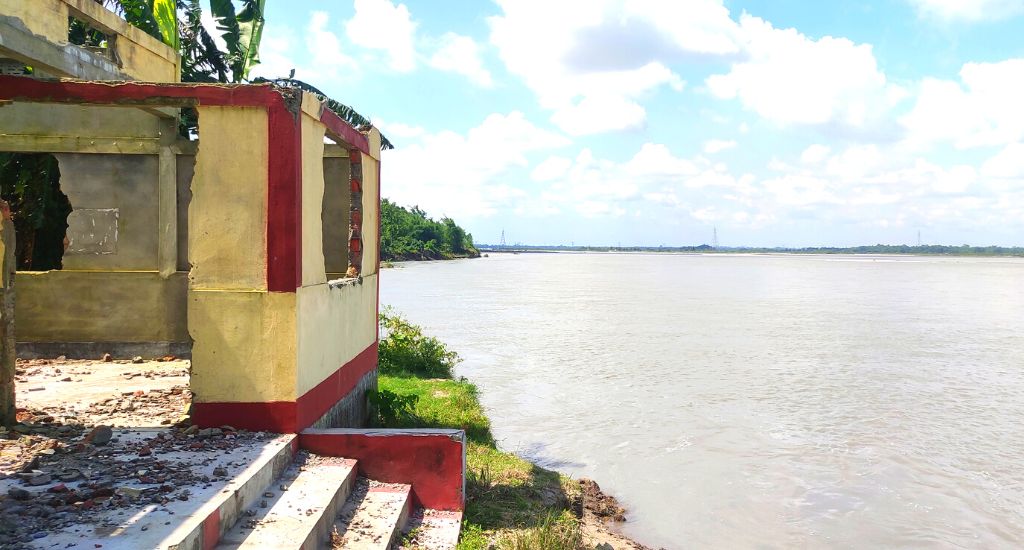
“The river’s already swept away several hundred houses. Now, we can only wait silently for our turn. What else can we do?” asks Burman, a weaver living in Gobardhana village near the community where Chhetri lives.
“Five years ago, the river was two kilometres away from our house but now it’s only 70 metres away. Soon, my home will be under the water too,” said Burman, her face creased in worry.
The lead image shows Small farmer Bhakto Bahadur Chhetri gazes despairingly at the river he knows will soon engulf his home.
Gurvinder Singh is a journalist based in Kolkata.